
Pipeline & Canal Survey
Overview
Ensuring the safe and efficient planning, construction, and maintenance of pipelines and canals requires precise survey data. Our drone-based aerial surveys provide accurate, cost-effective, and rapid insights that minimize risks and improve project execution.
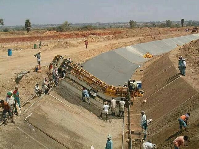
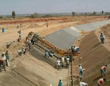
🔹 Canal Survey
Topographic Mapping & Alignment – Precise terrain data for canal route planning.
Embankment & Structure Monitoring – Check slope stability, lining quality, and canal structures.
Water Flow & Capacity Studies – Orthomosaic and DSM/DTM data for hydrological assessments.
Damage & Leakage Detection – Thermal and aerial inspection for seepage, cracks, or erosion.
Periodic Maintenance Surveys – Track siltation, vegetation growth, and encroachments.
🔹 Pipeline Survey
Route Alignment & Feasibility – Identify optimal pipeline routes with topographic mapping.
ROW (Right of Way) Mapping – Accurate corridor mapping for approvals and land acquisition.
Crossing Analysis – Survey of roads, railways, rivers, and utilities along the route.
Construction Monitoring – Track excavation, welding, and laying progress with drone imagery.
Integrity & Maintenance Checks – Detect leakages, erosion, or encroachments using aerial and thermal data.


Why Our Aerial Survey?
High accuracy in terrain & alignment data.
Thermal-enabled drones for leakage/seepage detection.
Faster execution over long linear projects.
Compliance-ready data for engineering & government approvals.
Expertise across pipelines, canals, mining, highways, smart cities, and renewable projects.
Get in touch
Contacts
+91-73504-90071
+91-96607-14080
Mail Us
skyhawksurvey@gmail.com
Head Office
56, Nakoda Nagar,
H.M. Sec.-3, Udaipur,
Rajasthan, INDIA.-313001