
Applications
Solutions We Provide
At SkyHawk Aerial Survey, we deliver a complete range of survey outputs that help clients make accurate, data-driven decisions. Our solutions cover everything from terrain modeling to volumetric analysis, tailored to the unique needs of mining, construction, infrastructure, agriculture, and urban development projects.
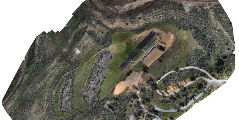
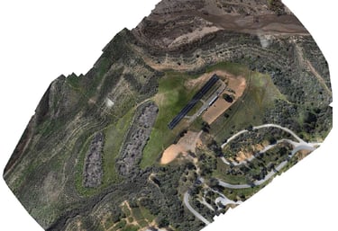
Orthomosaic Maps
High-resolution, georeferenced 2D maps created from drone imagery. Orthomosaics allow clients to view the entire site in detail, measure distances, and overlay designs for planning and compliance reporting.
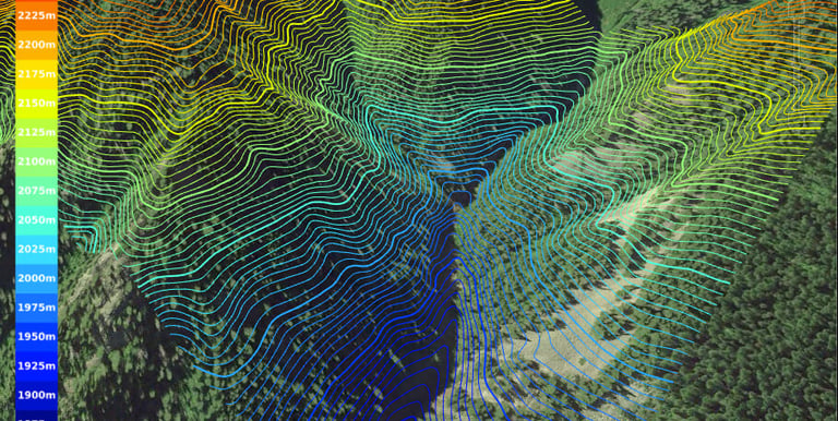
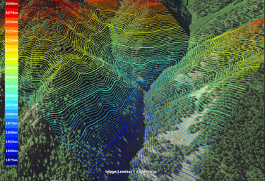
Contour Mapping
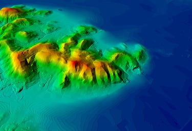
High-precision contour maps generated from drone data show elevation changes across a site. These are essential for design, planning, and volume calculations in mining, infrastructure, and land development

Digital Surface Model (DSM)
A DSM represents the earth’s surface including buildings, vegetation, and structures. It is useful for urban planning, solar and wind park design, forestry, and construction projects.
Digital Terrain Model (DTM)
A DTM strips away objects like trees and buildings to show the bare ground terrain. This is critical for cut & fill analysis, road/rail alignment, canal, and pipeline projects.
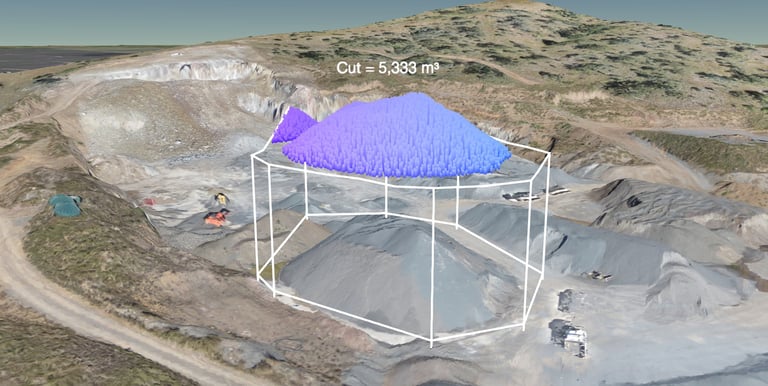
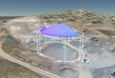
Volumetric Analysis
Accurate measurement of stockpiles, overburden, and excavation volumes using 3D drone data. Saves time and eliminates human error compared to manual measurement methods.
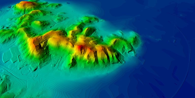
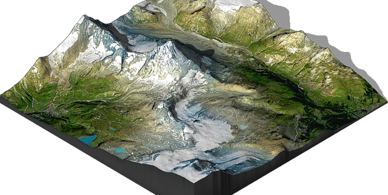
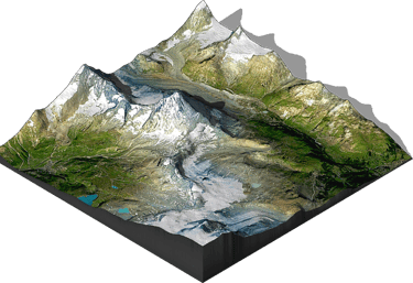
3D Terrain Models
Drone data processed into 3D interactive models, enabling visualization of complex terrains. These models are invaluable for mining lease surveys, urban planning, and archaeological site documentation.
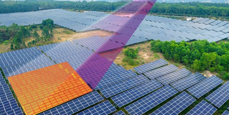

Thermal Inspection Maps
Heat signature analysis to detect defects in solar panels, power lines, and industrial equipment.
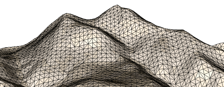
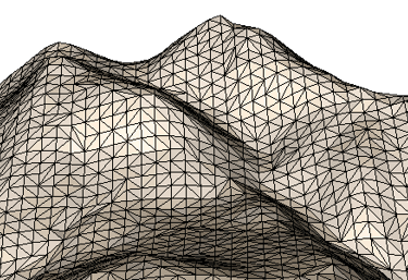
Triangulated Irregular Network (TIN)
Detailed 3D mesh models for slope stability, contour generation, and terrain studies.
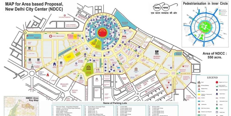
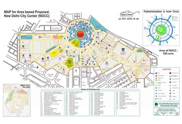
Urban Planning & Smart City Mapping
GIS-ready outputs for master plans, zoning, utilities planning, and infrastructure development.
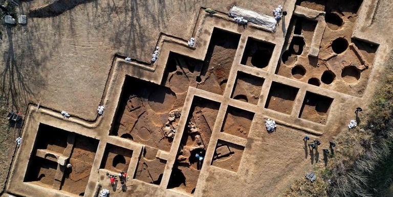
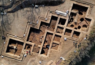
Archaeological & Heritage Site Survey
Detailed mapping and 3D models for documentation, preservation, and planning around heritage/archaeological sites.
Get in touch
Contacts
+91-73504-90071
+91-96607-14080
Mail Us
skyhawksurvey@gmail.com
Head Office
56, Nakoda Nagar,
H.M. Sec.-3, Udaipur,
Rajasthan, INDIA.-313001