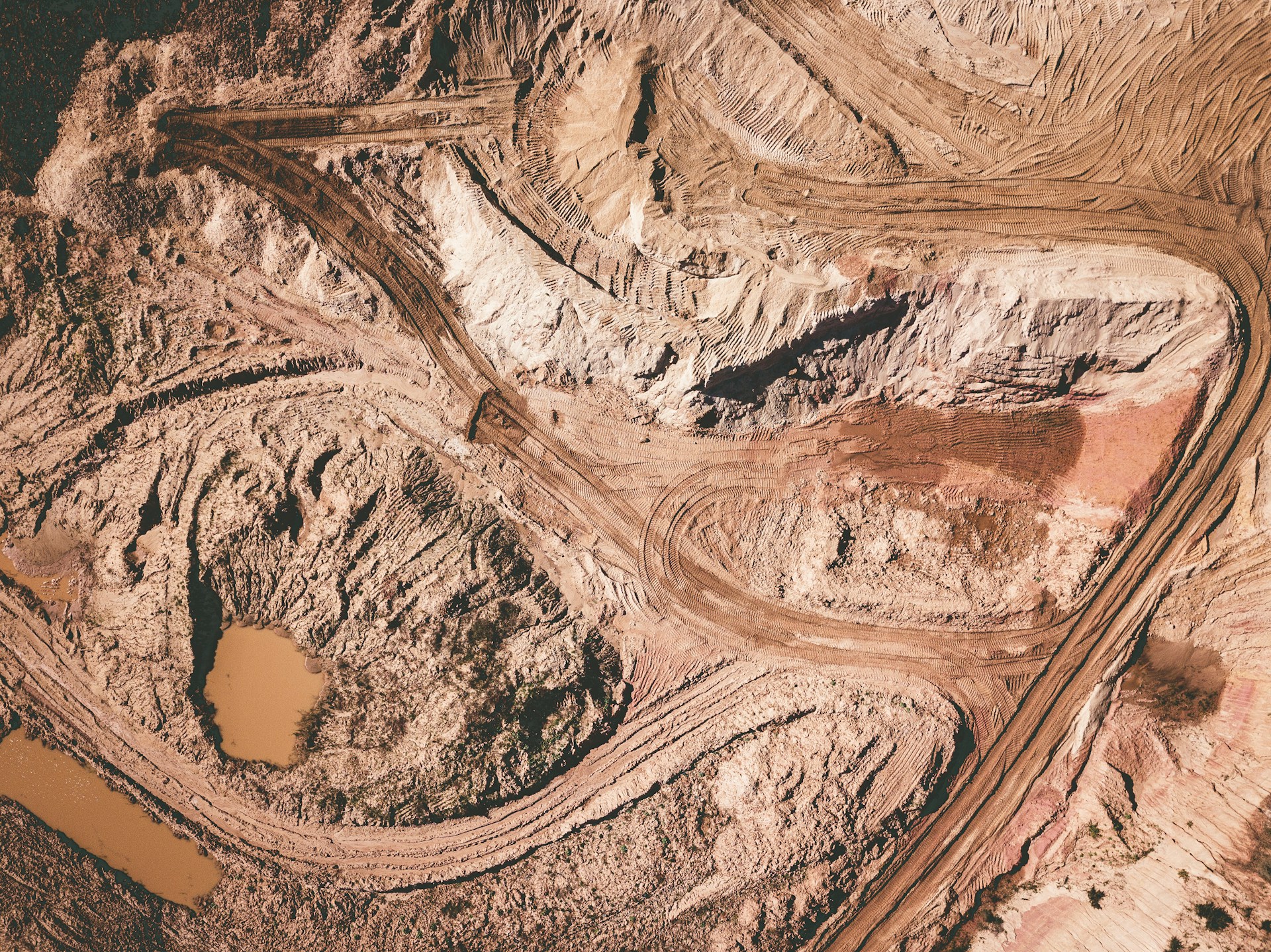
Mines Survey
Overview
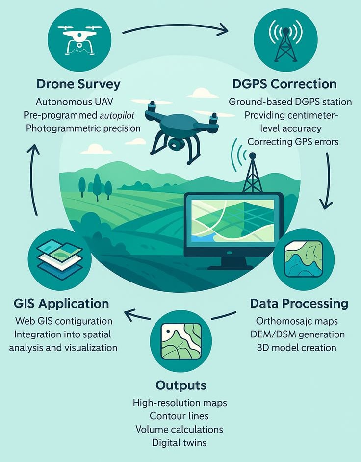
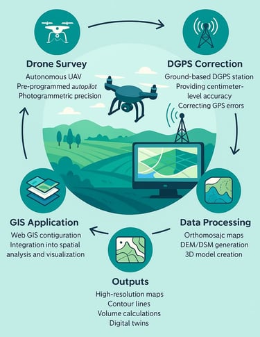
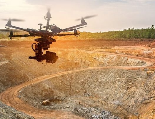
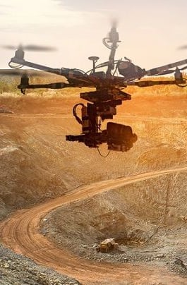
At SkyHawk Aerial Survey, we provide end-to-end drone-based surveying solutions for the mining industry across Rajasthan and all over India. With 10+ years of survey expertise, we have grown from Total Station and DGPS surveys to advanced DGCA-certified drone operations. Our surveys strictly follow IBM SOP compliance to ensure acceptance in regulatory submissions.
The Rajasthan Minor Mineral Concession (Second Amendment) Rules, 2024 have made drone surveys mandatory for mining leases. Lessees must now submit Digital Elevation Models (DEM) and Orthomosaic maps annually, and before submitting or modifying mining plans.
We support mining companies, lease holders, and government bodies like Indian Bureau of Mines, RMMC, RSMML, RSMET, NMET, and state mining departments, by delivering accurate, reliable, and legally compliant survey outputs.
Our Mining Survey Solutions
🔹 Survey for New Mining Leases
Drone-based mapping and contouring for lease applications, site selection, and boundary demarcation.
🔹 Mine Exploration Surveys
High-resolution aerial data for geological studies, resource assessment, and exploration planning.
🔹 Composite Mining License Surveys
Complete survey solutions to support the procedure and compliance requirements of composite mining licenses.
🔹 Mining Lease Compliance Surveys
Periodic IBM-compliant volume calculations, boundary checks, and progress monitoring.
🔹 Volumetric Analysis & Stockpile Measurement
Accurate ore, mineral, and overburden stock calculations to support reporting and operational efficiency.
🔹 Contour & Topographic Mapping
Elevation and terrain maps for planning pits, dumps, haul roads, and environmental compliance.
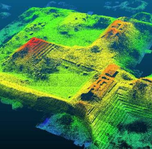
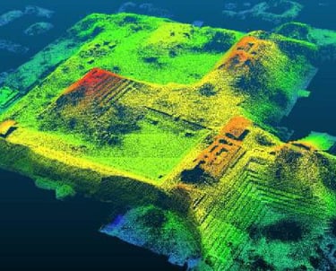
🔹 3D Terrain Models & TIN Surfaces
3D models for cut-fill analysis, slope stability, and mine planning.
🔹 Orthomosaic & High-Resolution Maps
Georeferenced 2D maps for detailed monitoring of lease areas, pits, and infrastructure.
🔹 Change Detection & Progress Monitoring
Track mine development, excavation, and reclamation over time..
🔹 Digital Surface Model (DSM)
Represents the surface including trees, buildings, and objects, useful for urban planning and renewable energy projects.
🔹 Digital Terrain Model (DTM)
Shows the bare earth surface (after removing objects), essential for road design, canals, and pipeline alignment.
Our DATA Solutions
Why Choose Us for Mine Surveys?
✔ IBM SOP Compliant – All surveys follow Indian Bureau of Mines standards.
✔ DGCA Certified – Safe and legal drone operations with licensed pilots.
✔ Centimeter Accuracy – Reliable outputs for reporting and decision-making.
✔ Time & Cost Savings – Faster than traditional survey methods.
✔ End-to-End Solutions – From aerial data capture to processed deliverables.
✔ Expertise – 10+ years of survey industry experience.
Applications in Mining
Lease boundary mapping
Stockpile & overburden volume measurement
Mine planning & expansion
Compliance reporting to IBM
Environmental & safety monitoring
Infrastructure monitoring (haul roads, pits, dumps)
Get in touch
Contacts
+91-73504-90071
+91-96607-14080
Mail Us
skyhawksurvey@gmail.com
Head Office
56, Nakoda Nagar,
H.M. Sec.-3, Udaipur,
Rajasthan, INDIA.-313001